February 17, 2025
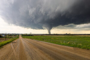
Policyholders in Southern California have been faced with complex challenges as wildfires, smoke and strong winds have caused unprecedented damage in the Los Angeles area. The wildfires have burned through about 40,000 acres in the region, damaging over 10,000 structures to date.
Technology has played a crucial role in how Sedgwick is helping clients navigate property losses caused by these wildfires. By leveraging new big data tools and powerful geographic information system (GIS) mapping capabilities, we are paving the way for how the independent loss adjusting industry responds to catastrophic weather events like wildfires.
Our property teams – including loss adjusters, building consultants, industrial hygienists and engineers – are currently using this technology to more rapidly assess damaged properties, remotely evaluate fire progression and enable real-time decisions. Our multi-layered tool allows adjusters to gain a deeper visibility into claims data and weather conditions. It includes data layers such as:
Advanced imaging – Effective property claims management starts with a thorough understanding of damages incurred during an event. Our platform gives property adjusters in California greater insight with access to publicly available street view images of homes and buildings. By comparing pre-loss conditions with images taken post-loss, adjusters can better assess the damages.
Weather and climate data – Wildfire conditions can change quickly due to powerful, unpredictable wind patterns. Sedgwick has invested in proprietary software that consolidates weather and climate data from various application programming interfaces (APIs) and data streams from trusted weather and mapping information providers. By adding visibility into real-time weather, wind and smoke conditions, adjusters can work a step ahead and rapidly scale client support as conditions change.
Geospatial data and mapping – API technology also powers the geographic data layer within the tool. With a direct pipeline into the most accurate geospatial and satellite data, information like longitude and latitude coordinates and property dimensions can help adjusters verify claims, begin assessments remotely even before an evacuated area is re-opened, and tailor their response as needed.
Local updates – As secondary responders, Sedgwick’s property adjusters closely follow safety guidelines outlined by local authorities. Within our technology, adjusters have access to the latest local updates, civil authority notices and evacuation orders related to the fires.
By infusing several layers of data, this powerful technology gives claims professionals better situational awareness as they respond to disasters; adjusters are armed with the latest data even before arriving at the loss site.
Sedgwick’s tool also employs predictive modeling techniques to map the progression of dangerous conditions, assess the potential impact to property, and take a proactive approach to claims management and risk mitigation. For example, wildfire-specific mapping models combined with smoke data have helped adjusters identify areas where properties could be affected primarily by smoke and soot damage, which can occur more than a hundred miles from the original wildfire. In this way, Sedgwick’s tools offer flexibility to support the various challenges faced by responders on-the-ground and give clients a strategic advantage.
Technology is an essential piece in advancing the way claims are handled, but it is not the only important factor. A caring approach is another must-have for improving claims outcomes. The experts behind the technology, administration and analysis of claims data bring empathy and understanding to survivors of life-changing events.
Sedgwick’s catastrophe (CAT) response team is here to provide claims support and help our clients navigate the unexpected when disasters occur. To learn more, visit our CAT resource center. If you need assistance with a claim, assign it to us at [email protected].